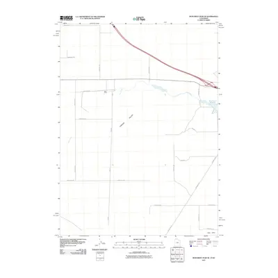
2011 Map of Monument Peak NE
USGS Topo · Published 2011About this map
Curlew Valley dominates the landscape in this high-desert region near the Utah-Idaho border, where large-scale ranching and water management define the settlement pattern. The central feature of the area is Rose Ranch, supported by the irrigation provided by Rose Ranch Reservoir and the drainage of Deep Creek. The map reveals a highly structured grid of section roads, including 33520 Rd and 24400 North Rd, which intersect the expansive agricultural lands. In the southeastern corner, the terrain transitions into Sage Valley, with the historically named Locomotive Rd cutting a diagonal path through the basin. This survey documents the intersection of modern interstate infrastructure with the enduring cattle-ranching heritage of Box Elder County.
Find a feature on this map
22 named features on this map. Tap any name to fly to it.
Don’t see what you’re looking for? This feature index may not catch every label — zoom into the map to look around manually.
Map Details
Editions of this 2011 Monument Peak NE Map
This is the sole edition of this map. No revisions or reprints were ever made.
Other maps of this area

1954 · Pocatello
USGS Topo · 1:250,000

1954 · Brigham City
USGS Topo · 1:250,000

1958 · Pocatello
USGS Topo · 1:250,000

1958 · Brigham City
USGS Topo · 1:250,000

1962 · Brigham City
USGS Topo · 1:250,000

1968 · Salt Wells
USGS Topo · 1:24,000

1968 · Monument Peak NW
USGS Topo · 1:24,000

1968 · Monument Peak SW
USGS Topo · 1:24,000

1968 · Snowville
USGS Topo · 1:24,000

1968 · Monument Peak
USGS Topo · 1:24,000