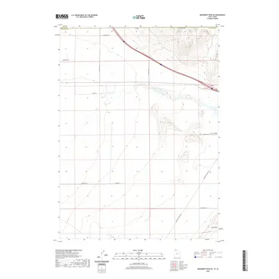
2020 Map of Monument Peak NE
USGS Topo · Published 2020About this map
Curlew Valley and Sage Valley dominate this northern Utah landscape, where the state line meets Idaho along the northern edge of Box Elder County. The terrain is defined by the winding course of Deep Creek, which cuts through the center of the sheet below the Stone Hills. This area is characterized by a high-desert grid of rural routes, including 34000 West Rd and 32400 West Rd, which facilitate movement through the open basins. The presence of Locomotive Springs Rd in the southeastern corner suggests the historical connectivity to the spring-fed systems further south. This survey reflects the modern management of these traditional ranching lands, illustrating the precise boundaries between Oneida and Box Elder counties and the systematic layout of the region's roadway network.
Find a feature on this map
18 named features on this map. Tap any name to fly to it.
Don’t see what you’re looking for? This feature index may not catch every label — zoom into the map to look around manually.
Map Details
Editions of this 2020 Monument Peak NE Map
This is the sole edition of this map. No revisions or reprints were ever made.
Other maps of this area

1954 · Pocatello
USGS Topo · 1:250,000

1954 · Brigham City
USGS Topo · 1:250,000

1958 · Pocatello
USGS Topo · 1:250,000

1958 · Brigham City
USGS Topo · 1:250,000

1962 · Brigham City
USGS Topo · 1:250,000

1968 · Salt Wells
USGS Topo · 1:24,000

1968 · Monument Peak NW
USGS Topo · 1:24,000

1968 · Monument Peak SW
USGS Topo · 1:24,000

1968 · Snowville
USGS Topo · 1:24,000

1968 · Monument Peak
USGS Topo · 1:24,000