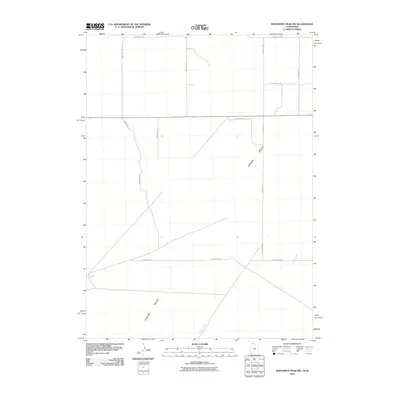
2011 Map of Monument Peak NW
USGS Topo · Published 2011About this map
The Curlew Valley landscape defines this 2011 survey, showing a remote agricultural and high-desert region straddling the Utah-Idaho border. The map is primarily characterized by its vast, open terrain organized by a strict grid of section roads and highway Highway 30, which cuts east-to-west through the center of the quadrangle. Water sources are scarce in this arid basin, with Deep Creek and Coyote Spring serving as the primary hydrological landmarks for the area. The settlement pattern is minimal, defined by long stretches of gravel and dirt thoroughfares such as 27440 North Rd and 36400 West Rd, which provide access to the expansive rangelands and occasional agricultural infrastructure. This edition captures the rural isolation of the borderlands before any significant modern development altered the cattle-and-crops character of the valley floor.
Find a feature on this map
13 named features on this map. Tap any name to fly to it.
Don’t see what you’re looking for? This feature index may not catch every label — zoom into the map to look around manually.
Map Details
Editions of this 2011 Monument Peak NW Map
This is the sole edition of this map. No revisions or reprints were ever made.
Other maps of this area

1954 · Pocatello
USGS Topo · 1:250,000

1954 · Brigham City
USGS Topo · 1:250,000

1958 · Pocatello
USGS Topo · 1:250,000

1958 · Brigham City
USGS Topo · 1:250,000

1959 · Strevell
USGS Topo · 1:62,500

1959 · Kelton Pass
USGS Topo · 1:62,500

1962 · Brigham City
USGS Topo · 1:250,000

1968 · Monument Peak NW
USGS Topo · 1:24,000

1968 · Monument Peak SW
USGS Topo · 1:24,000

1968 · Monument Peak
USGS Topo · 1:24,000