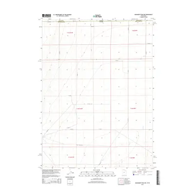
2014 Map of Monument Peak NW
USGS Topo · Published 2014About this map
The high desert along the border of Box Elder County, Utah, and Oneida County, Idaho, is defined by an expansive grid of section lines and remote access roads in this 2014 survey. The landscape is largely arid, marked by the presence of Coyote Spring in the southwest and the winding path of Deep Cr as it flows through the southeastern sections. This territory serves as a transition between the elevated terrain of the Wildcat Mountains and the open basins below.
Find a feature on this map
26 named features on this map. Tap any name to fly to it.
Don’t see what you’re looking for? This feature index may not catch every label — zoom into the map to look around manually.
Map Details
Editions of this 2014 Monument Peak NW Map
This is the sole edition of this map. No revisions or reprints were ever made.
Other maps of this area

1954 · Pocatello
USGS Topo · 1:250,000

1954 · Brigham City
USGS Topo · 1:250,000

1958 · Pocatello
USGS Topo · 1:250,000

1958 · Brigham City
USGS Topo · 1:250,000

1959 · Strevell
USGS Topo · 1:62,500

1959 · Kelton Pass
USGS Topo · 1:62,500

1962 · Brigham City
USGS Topo · 1:250,000

1968 · Monument Peak NW
USGS Topo · 1:24,000

1968 · Monument Peak SW
USGS Topo · 1:24,000

1968 · Monument Peak
USGS Topo · 1:24,000