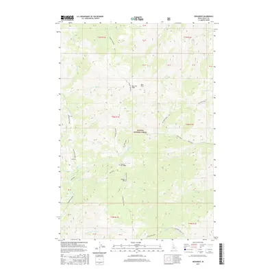
2017 Map of Monument
USGS Topo · Published 2017About this map
Payette National Forest dominates this section of central Idaho, where the high elevations of Lookout Mountain and Lookout Mtn Ridge define the drainage patterns of the Salmon River mountains. The landscape is carved by a dense network of watercourses, including the north-flowing Monumental Creek and the headwaters of Telephone Creek in the south. A specific landmark simply labeled Monument sits near the banks of Monument Creek, suggesting an early surveyor’s mark or a site of local significance. High-altitude features like Milk Lake and the prominent Big Creek Ridge illustrate the complex topography of the region, while numerous smaller streams such as Chalk Creek and Paint Creek flow through the deep canyons. This area remains primarily a wilderness environment, mapped for its hydraulic and forest resources by the U.S. Geological Survey.
Find a feature on this map
48 named features on this map. Tap any name to fly to it.
Don’t see what you’re looking for? This feature index may not catch every label — zoom into the map to look around manually.
Map Details
Editions of this 2017 Monument Map
This is the sole edition of this map. No revisions or reprints were ever made.
Other maps of this area

1930 · Casto
USGS Topo · 1:125,000

1956 · Elk City
USGS Topo · 1:250,000

1957 · Challis
USGS Topo · 1:250,000

1960 · Elk City
USGS Topo · 1:250,000

1960 · Challis
USGS Topo · 1:250,000

1962 · Mormon Mtn
USGS Topo · 1:24,000

1962 · Vinegar Hill
USGS Topo · 1:24,000

1962 · Shellrock Peak
USGS Topo · 1:24,000

1963 · Challis
USGS Topo · 1:250,000

1973 · Center Mtn
USGS Topo · 1:24,000