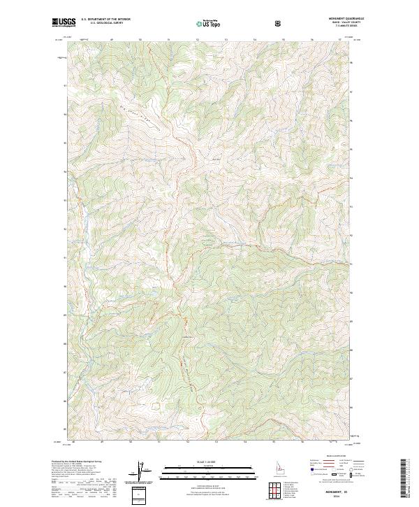
2024 Map of Monument
USGS Topo · Published 2024About this map
The Frank Church-River of No Return Wilderness and Payette National Forest encompass this remote Idaho landscape, characterized by a complex network of high ridges and drainage basins. Central to the geography is Lookout Mtn, which anchors the Lookout Mountain Ridge and serves as a primary waypoint for several backcountry routes, including the Lookout Mountain Trl.
Find a feature on this map
46 named features on this map. Tap any name to fly to it.
Don’t see what you’re looking for? This feature index may not catch every label — zoom into the map to look around manually.
Map Details
Editions of this 2024 Monument Map
This is the sole edition of this map. No revisions or reprints were ever made.
Other maps of this area

1930 · Casto
USGS Topo · 1:125,000

1956 · Elk City
USGS Topo · 1:250,000

1957 · Challis
USGS Topo · 1:250,000

1960 · Elk City
USGS Topo · 1:250,000

1960 · Challis
USGS Topo · 1:250,000

1962 · Mormon Mtn
USGS Topo · 1:24,000

1962 · Vinegar Hill
USGS Topo · 1:24,000

1962 · Shellrock Peak
USGS Topo · 1:24,000

1963 · Challis
USGS Topo · 1:250,000

1973 · Center Mtn
USGS Topo · 1:24,000