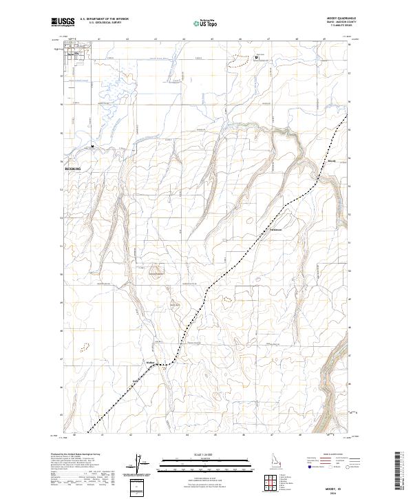
2024 Map of Moody
USGS Topo · Published 2024About this map
Sugar City and the eastern outskirts of Rexburg anchor the northwestern corner of this Madison County landscape, where the agricultural plains meet the rising foothills. The complex water management system of the Upper Snake River Valley is clearly documented, featuring the South Teton River alongside an intricate network of irrigation works including the Teton Island Canal, Woodmansee Johnson Canal, and East Teton Canal. These man-made waterways define the local economy and settlement patterns, supporting small communities like Parkinson and Moody. To the south, the terrain transitions into more prominent landmarks such as Sommers Butte and Webster Butte, while the drainage of Moody Creek carves through the eastern portion of the quadrangle. Local heritage is preserved at sites like the Sugar City Cem and Teton Cem, which serve as quiet markers of the area's early residents.
Find a feature on this map
55 named features on this map. Tap any name to fly to it.
Don’t see what you’re looking for? This feature index may not catch every label — zoom into the map to look around manually.
Map Details
Editions of this 2024 Moody Map
This is the sole edition of this map. No revisions or reprints were ever made.
Other maps of this area

1948 · Parker
USGS Topo · 1:24,000

1949 · Rexburg
USGS Topo · 1:24,000

1949 · Newdale
USGS Topo · 1:24,000

1950 · Ririe
USGS Topo · 1:24,000

1950 · Parker
USGS Topo · 1:24,000

1950 · Rexburg
USGS Topo · 1:24,000

1950 · Newdale
USGS Topo · 1:24,000

1950 · St Anthony
USGS Topo · 1:24,000

1950 · Rigby
USGS Topo · 1:62,500

1951 · Moody
USGS Topo · 1:24,000