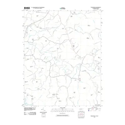
2010 Map of Moodyville
USGS Topo · Published 2010About this map
The Wolf River meanders across this northern Tennessee landscape, carving deep valleys and defining the rural character of the region. Dozens of small family and community burial grounds, such as the Flowers-Zachary Cemetery, Scotch-Rich Cemetery, and Upchurch Cemetery, are scattered among the ridges, providing a clear map of early settlement patterns and genealogical roots. The topography is defined by prominent elevations like Huddleston Knob and the Double Top Mountain, while the southern portion of the map reaches the waters of Dale Hollow Lake.
Find a feature on this map
117 named features on this map. Tap any name to fly to it.
Don’t see what you’re looking for? This feature index may not catch every label — zoom into the map to look around manually.
Map Details
Editions of this 2010 Moodyville Map
This is the sole edition of this map. No revisions or reprints were ever made.
Other maps of this area

1895 · Wartburg
USGS Topo · 1:125,000

1896 · Wartburg
USGS Topo · 1:125,000

1897 · Standingstone
USGS Topo · 1:125,000

1898 · Standingstone
USGS Topo · 1:125,000

1929 · Byrdstown
USGS Topo · 1:62,500

1934 · Pall Mall
USGS Topo · 1:62,500

1954 · Albany
USGS Topo · 1:24,000

1954 · Jamestown
USGS Topo · 1:24,000

1954 · Savage
USGS Topo · 1:24,000

1954 · Powersburg
USGS Topo · 1:24,000