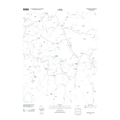
2013 Map of Moodyville
USGS Topo · Published 2013About this map
Wolf River snakes through this Pickett County landscape, defining the topography between the Kentucky state line and the northern reaches of Dale Hollow Lake. The terrain is characterized by numerous knobs and mountains, including Double Top Mountain and Littoral Mountain, which overlook a network of rural settlements such as Moodyville, Chanute, and Asbury. A point of particular interest for local history is the Gilreath Mill, situated near Red Hill along Holbert Cr. The map preserves the locations of several river crossings, including Backbone Ford and Riley Ford, which once served as vital connectors in the days before modern bridge infrastructure. Numerous family-named roads and landmarks, like Hildreth Knob and Poore Knob, provide a glimpse into the genealogical footprint of the area. Significant religious and communal sites are documented at Mount Union, which includes both a settlement and a named church, alongside cemeteries accessed via Clark Cemetery Rd and Pulse Cemetery Rd.
Find a feature on this map
153 named features on this map. Tap any name to fly to it.
Don’t see what you’re looking for? This feature index may not catch every label — zoom into the map to look around manually.
Map Details
Editions of this 2013 Moodyville Map
This is the sole edition of this map. No revisions or reprints were ever made.
Other maps of this area

1895 · Wartburg
USGS Topo · 1:125,000

1896 · Wartburg
USGS Topo · 1:125,000

1897 · Standingstone
USGS Topo · 1:125,000

1898 · Standingstone
USGS Topo · 1:125,000

1929 · Byrdstown
USGS Topo · 1:62,500

1934 · Pall Mall
USGS Topo · 1:62,500

1954 · Albany
USGS Topo · 1:24,000

1954 · Jamestown
USGS Topo · 1:24,000

1954 · Savage
USGS Topo · 1:24,000

1954 · Powersburg
USGS Topo · 1:24,000