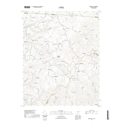
2019 Map of Moodyville
USGS Topo · Published 2019About this map
Moodyville and the winding course of the Wolf River define this pocket of the Upper Cumberland, where the Tennessee-Kentucky state line meets the intersection of Pickett, Clinton, and Fentress counties. The landscape is characterized by a high density of family cemeteries, such as the Flowers-Zachary Cem and Upchurch Cem, which serve as vital markers of the area's ancestral homesteads and rural communities. Distinctive topographical features like Double Top Mtn and Step Gap overlook a terrain carved by numerous tributaries, including Lick Creek and Hurricane Cr. Settled nodes such as Gilreath Mill, Chanute, and Asbury are linked by a network of local routes like Old Kentucky Rd and Harlan Lee Rd, reflecting a long-standing agricultural and river-based economy. The presence of Duncan Sink further illustrates the complex karst drainage systems common to this highland region.
Find a feature on this map
158 named features on this map. Tap any name to fly to it.
Don’t see what you’re looking for? This feature index may not catch every label — zoom into the map to look around manually.
Map Details
Editions of this 2019 Moodyville Map
This is the sole edition of this map. No revisions or reprints were ever made.
Other maps of this area

1895 · Wartburg
USGS Topo · 1:125,000

1896 · Wartburg
USGS Topo · 1:125,000

1897 · Standingstone
USGS Topo · 1:125,000

1898 · Standingstone
USGS Topo · 1:125,000

1929 · Byrdstown
USGS Topo · 1:62,500

1934 · Pall Mall
USGS Topo · 1:62,500

1954 · Albany
USGS Topo · 1:24,000

1954 · Jamestown
USGS Topo · 1:24,000

1954 · Savage
USGS Topo · 1:24,000

1954 · Powersburg
USGS Topo · 1:24,000