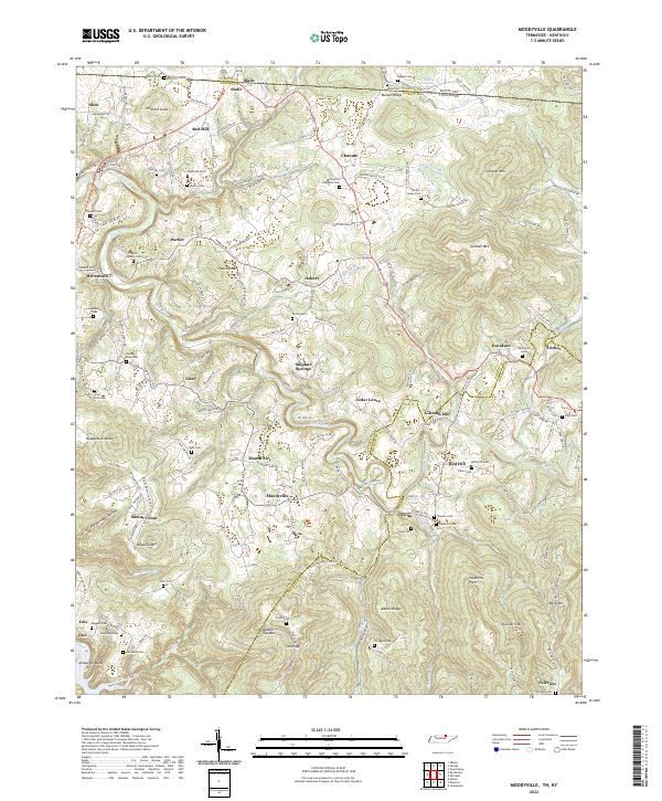
2022 Map of Moodyville
USGS Topo · Published 2022About this map
Gilreath Mill stands as a focal point in this portion of Pickett County, where the Wolf River winds through a landscape defined by significant family-named ridges and gaps. The map documents a dense network of family burials, including the Edgefield Cem, Parris-Riley Cem, and Scott-Rich Cem, providing a detailed record for genealogical research in rural Tennessee.
Find a feature on this map
157 named features on this map. Tap any name to fly to it.
Don’t see what you’re looking for? This feature index may not catch every label — zoom into the map to look around manually.
Map Details
Editions of this 2022 Moodyville Map
This is the sole edition of this map. No revisions or reprints were ever made.
Other maps of this area

1895 · Wartburg
USGS Topo · 1:125,000

1896 · Wartburg
USGS Topo · 1:125,000

1897 · Standingstone
USGS Topo · 1:125,000

1898 · Standingstone
USGS Topo · 1:125,000
1929 · Byrdstown
USGS Topo · 1:62,500
1934 · Pall Mall
USGS Topo · 1:62,500
1954 · Albany
USGS Topo · 1:24,000
1954 · Jamestown
USGS Topo · 1:24,000
1954 · Savage
USGS Topo · 1:24,000
1954 · Powersburg
USGS Topo · 1:24,000