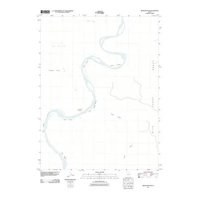
2011 Map of Moon Bottom
USGS Topo · Published 2011About this map
The Green River snakes through a series of wide riverbanks and alluvial flats in this remote section of Uintah County. These low-lying areas, labeled as "bottoms," indicate a long history of seasonal flooding and sediment deposition that shaped the local geography. Distinct named locations such as Moon Bottom, Snider Bottom, and Hydes Bottom define the navigable path of the water as it winds south past Canyon Bottom and Long Bottom.
Find a feature on this map
14 named features on this map. Tap any name to fly to it.
Don’t see what you’re looking for? This feature index may not catch every label — zoom into the map to look around manually.
Map Details
Editions of this 2011 Moon Bottom Map
This is the sole edition of this map. No revisions or reprints were ever made.
Other maps of this area

1885 · East Tavaputs
USGS Topo · 1:250,000

1885 · Ashley
USGS Topo · 1:250,000

1917 · Vernal
USGS Topo · 1:125,000

1953 · Nutters Hole
USGS Topo · 1:62,500

1954 · Vernal
USGS Topo · 1:250,000

1956 · Grand Junction
USGS Topo · 1:250,000

1958 · Vernal
USGS Topo · 1:250,000

1959 · Grand Junction
USGS Topo · 1:250,000

1960 · Vernal
USGS Topo · 1:250,000

1960 · Grand Junction
USGS Topo · 1:250,000