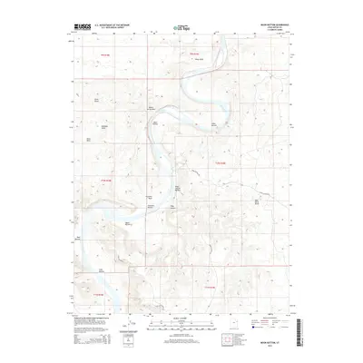
2014 Map of Moon Bottom
USGS Topo · Published 2014About this map
The Green River carves a winding path through this corner of the Uinta Basin, creating a sequence of fertile lowlands known as "bottoms." These riparian stretches, including Moon Bottom, Snider Bottom, and Hydes Bottom, represent vital resources in an otherwise arid landscape defined by the Little Desert and the high elevation of Wild Horse Bench. The map illustrates the topographic relationship between the river's floodplains and the surrounding plateau, where dry drainages like Sheep Wash and Fourmile Wash descend from the upland benches. Local access is primarily defined by unpaved routes such as Moon Bottom Rd and Kings Canyon Rd, which navigate the complex terrain. This 2014 survey documents the enduring physical character of the river corridor, highlighting the contrast between the green riverbanks and the stark elevations of Antelope Knolls.
Find a feature on this map
25 named features on this map. Tap any name to fly to it.
Don’t see what you’re looking for? This feature index may not catch every label — zoom into the map to look around manually.
Map Details
Editions of this 2014 Moon Bottom Map
This is the sole edition of this map. No revisions or reprints were ever made.
Other maps of this area

1885 · East Tavaputs
USGS Topo · 1:250,000

1885 · Ashley
USGS Topo · 1:250,000

1917 · Vernal
USGS Topo · 1:125,000

1953 · Nutters Hole
USGS Topo · 1:62,500

1954 · Vernal
USGS Topo · 1:250,000

1956 · Grand Junction
USGS Topo · 1:250,000

1958 · Vernal
USGS Topo · 1:250,000

1959 · Grand Junction
USGS Topo · 1:250,000

1960 · Vernal
USGS Topo · 1:250,000

1960 · Grand Junction
USGS Topo · 1:250,000