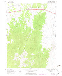
1968 Map of Moor Summit
USGS Topo · Published 1983About this map
Wood Hills dominate this high-desert landscape in northeastern Nevada, rising above the western edge of Independence Valley. This survey, updated in the early 1980s, highlights the critical transportation corridor crossing the northern part of the map. Here, the Southern Pacific railroad and a major highway traverse Cedar Pass between the Wood Hills and the Windermere Hills. The small station or siding of Moor and the high point at Moor Summit mark this important divide.
Find a feature on this map
14 named features on this map. Tap any name to fly to it.
Don’t see what you’re looking for? This feature index may not catch every label — zoom into the map to look around manually.
Map Details
Editions of this 1968 Moor Summit Map
3 editions found
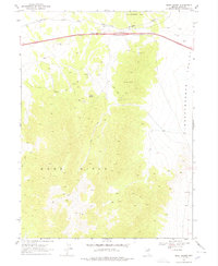
Other maps of this area

1955 · Wells
USGS Topo · 1:250,000

1955 · Elko
USGS Topo · 1:250,000

1958 · Wells
USGS Topo · 1:250,000

1958 · Elko
USGS Topo · 1:250,000

1961 · Wells
USGS Topo · 1:250,000

1962 · Elko
USGS Topo · 1:250,000

1965 · Elko
USGS Topo · 1:250,000

1968 · Moor Summit
USGS Topo · 1:24,000

1968 · Holborn
USGS Topo · 1:24,000

1968 · Wells
USGS Topo · 1:24,000