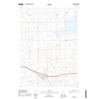
2017 Map of Moorcroft
USGS Topo · Published 2017About this map
Moorcroft serves as the primary hub of activity in this Crook County landscape, situated along the southern bend of the Belle Fourche River. The town is characterized by a concentrated grid of streets, including W Goshen St and Prairie St, and houses the Moorcroft Cem on its northern edge. The surrounding terrain is a network of drainages and seasonal waterways such as Donkey Cr and Rush Cr, which feed into the river system.
Find a feature on this map
39 named features on this map. Tap any name to fly to it.
Don’t see what you’re looking for? This feature index may not catch every label — zoom into the map to look around manually.
Map Details
Editions of this 2017 Moorcroft Map
This is the sole edition of this map. No revisions or reprints were ever made.
Other maps of this area

1918 · Moorcroft
USGS Topo · 1:125,000

1918 · Moorcroft
USGS Topo · 1:62,500

1954 · Carlile
USGS Topo · 1:24,000

1954 · Gillette
USGS Topo · 1:250,000

1955 · Gillette
USGS Topo · 1:250,000

1957 · Moorcroft
USGS Topo · 1:62,500

1958 · Gillette
USGS Topo · 1:250,000

1962 · Gillette
USGS Topo · 1:250,000
1971 · Rozet SE
USGS Topo · 1:24,000
1971 · Rozet NE
USGS Topo · 1:24,000