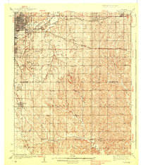
1938 Map of Moore
USGS Topo · Published 1938About this map
The Canadian River flows across the northwest corner of this landscape, framing the industrial and agricultural expansion of the late 1930s. Oklahoma City spills into the corner of the sheet, marked by numerous Oil Tanks and the County Farm, while the surrounding countryside is densely populated with small rural institutions. A remarkable network of country schools, including Foster High Sch, Mishak Sch, and Lawn Ridge Sch, illustrates the decentralized education system of the era. Settlement patterns follow the railroads, with the Chicago Rock Island and Pacific and the St Louis-San Francisco lines cutting through the northern townships. To the south, the community of Moore sits at a crossroads, while Hollywood Corners and Franklin anchor the lower sections of the quadrangle, connected by a web of creeks like the Little River and Crutcho Creek.
Find a feature on this map
59 named features on this map. Tap any name to fly to it.
Don’t see what you’re looking for? This feature index may not catch every label — zoom into the map to look around manually.
Map Details
Editions of this 1938 Moore Map
2 editions found

Other maps of this area

1892 · Moore
USGS Topo · 1:62,500

1892 · Edmond
USGS Topo · 1:62,500

1892 · Kingfisher
USGS Topo · 1:125,000

1893 · Norman
USGS Topo · 1:62,500

1893 · Oklahoma City
USGS Topo · 1:62,500

1895 · Kingfisher
USGS Topo · 1:125,000

1898 · Purcell
USGS Topo · 1:125,000

1904 · Chickasha
USGS Topo · 1:125,000

1909 · Luther
USGS Topo · 1:62,500

1910 · McComb
USGS Topo · 1:62,500