
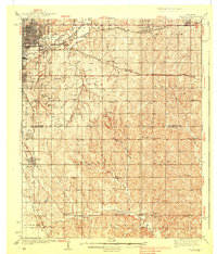
1938 Map of Moore
USGS Topo · Published 1938About this map
The southern outskirts of Oklahoma City and the growing township of Moore are defined by an intricate network of early railroads and a burgeoning petroleum industry during the mid-1930s. Major rail lines including the St Louis - San Francisco and the Atchison Topeka and Santa Fe crisscross the landscape, linking the urban center to outlying communities like Bodine City and Nicoma Park. Near the banks of the Canadian River, the presence of extensive oil tanks signals the region's mid-century industrial expansion.
Find a feature on this map
55 named features on this map. Tap any name to fly to it.
Don’t see what you’re looking for? This feature index may not catch every label — zoom into the map to look around manually.
Map Details
Editions of this 1938 Moore Map
2 editions found
Other maps of this area

1892 · Moore
USGS Topo · 1:62,500

1892 · Edmond
USGS Topo · 1:62,500

1892 · Kingfisher
USGS Topo · 1:125,000

1893 · Norman
USGS Topo · 1:62,500

1893 · Oklahoma City
USGS Topo · 1:62,500

1895 · Kingfisher
USGS Topo · 1:125,000

1898 · Purcell
USGS Topo · 1:125,000

1904 · Chickasha
USGS Topo · 1:125,000

1909 · Luther
USGS Topo · 1:62,500

1910 · McComb
USGS Topo · 1:62,500