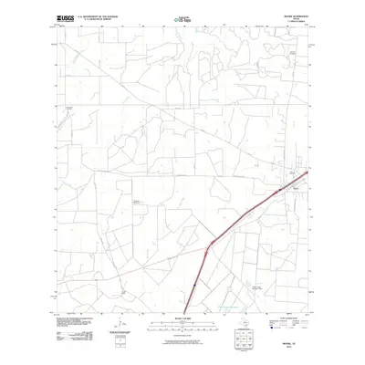
2010 Map of Moore
USGS Topo · Published 2010About this map
Moore serves as the primary settlement hub in this part of Frio County, situated where major transit corridors intersect the South Texas brush country. The landscape is defined by a dendritic drainage pattern of intermittent streams, including Hondo Creek, Tehuacana Creek, and Buck Creek, which feed into localized reservoirs such as the Sirrianni Lake Dam and Triple S Lake Number 2. For genealogists and local historians, the presence of Tomerlin Cemetery, Tehuacana Cemetery, and the Moore Cemetery offers significant research value, marking the community's established history and family lineages. The road network, including Yancey Rd and Tehuacana Rd, suggests a rural economy tied to ranching, as evidenced by the Gracey Ranch to the southwest. The infrastructure reflects a blend of traditional ranching boundaries and modern highway development, providing a clear view of land use during this era.
Find a feature on this map
26 named features on this map. Tap any name to fly to it.
Don’t see what you’re looking for? This feature index may not catch every label — zoom into the map to look around manually.
Map Details
Editions of this 2010 Moore Map
This is the sole edition of this map. No revisions or reprints were ever made.
Other maps of this area

1925 · Pearsall 1-b
USGS Topo · 1:48,000

1927 · Pearsall
USGS Topo · 1:62,500

1934 · Schattel
USGS Topo · 1:62,500

1942 · Natalia
USGS Topo · 1:62,500

1953 · Crystal City
USGS Topo · 1:250,000

1954 · San Antonio
USGS Topo · 1:250,000

1955 · Crystal City
USGS Topo · 1:250,000

1957 · San Antonio
USGS Topo · 1:250,000

1961 · Crystal City
USGS Topo · 1:250,000

1964 · Ghost Hill
USGS Topo · 1:24,000