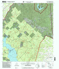
1997 Map of Moore Grove
USGS Topo · Published 2000About this map
Sam Houston National Forest dominates this landscape in Walker County, where the dense timber of East Texas meets the northern reaches of Lake Conroe. In the late 20th century, this area maintained a mix of public recreational land and private ranching interests, such as Lost Meadows Ranch and M-Fodr Ranch. The map captures the interface between managed wilderness and small rural settlements like Bath and Moore Grove. Significant landmarks for local history include the Union Hill Cemetery and the Old Folks Home located near the eastern boundary. Water resources define the terrain, from the sprawling lakefront at the southern edge to interior bodies like Lake Raven within Huntsville State Park. The road network, including Possum Walk Road, connects these remote outposts and lookout towers, such as the Bath Lookout, which once served as vital points for forest fire surveillance.
Find a feature on this map
46 named features on this map. Tap any name to fly to it.
Don’t see what you’re looking for? This feature index may not catch every label — zoom into the map to look around manually.
Map Details
Editions of this 1997 Moore Grove Map
This is the sole edition of this map. No revisions or reprints were ever made.
Other maps of this area

1954 · Beaumont
USGS Topo · 1:250,000

1957 · Beaumont
USGS Topo · 1:250,000

1958 · Lake Paula
USGS Topo · 1:24,000

1959 · Moore Grove
USGS Topo · 1:24,000

1959 · San Jacinto
USGS Topo · 1:24,000

1959 · Montgomery
USGS Topo · 1:24,000

1960 · Willis
USGS Topo · 1:24,000

1960 · New Waverly
USGS Topo · 1:24,000

1960 · Phelps
USGS Topo · 1:24,000

1962 · Galilee
USGS Topo · 1:24,000