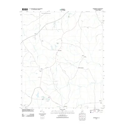
2011 Map of Moorefield
USGS Topo · Published 2011About this map
Oak Bowery and the surrounding rural landscape of Chambers County are defined by a network of creeks and small family-named settlements. The area around Moorefield is marked by a series of agricultural and water-management features, including Dempsey Dam and the J H Hines Lake to the north. This 2011 survey reveals a territory where local history is preserved in numerous burial grounds, such as Antioch Cemetery, Sturkie Cemetery, and Boyds Cemetery.
Find a feature on this map
54 named features on this map. Tap any name to fly to it.
Don’t see what you’re looking for? This feature index may not catch every label — zoom into the map to look around manually.
Map Details
Editions of this 2011 Moorefield Map
This is the sole edition of this map. No revisions or reprints were ever made.
Other maps of this area

1906 · Dadeville
USGS Topo · 1:125,000

1907 · Opelika
USGS Topo · 1:125,000

1909 · Opelika
USGS Topo · 1:125,000

1955 · Phenix City
USGS Topo · 1:250,000

1957 · Phenix City
USGS Topo · 1:250,000

1958 · Phenix City
USGS Topo · 1:250,000

1970 · Opelika East
USGS Topo · 1:24,000

1971 · Waverly
USGS Topo · 1:24,000
1971 · Cusseta
USGS Topo · 1:24,000
1971 · Moorefield
USGS Topo · 1:24,000