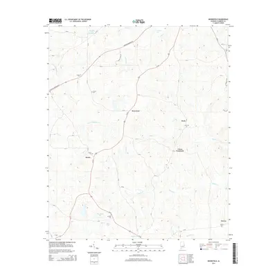
2014 Map of Moorefield
USGS Topo · Published 2014About this map
Moorefield serves as the central hub of this Chambers County landscape, situated along the corridor of Us-431. The area is defined by its small crossroads settlements and numerous rural burial sites, such as Antioch Cem and Spratling Cem, which provide significant points of interest for genealogical research. The terrain is drained by a network of waterways including Little Chatahospce Cr and Snapper Cr, which feed into several local impoundments like Jeff Beards Lake and Edgar Lake. To the east, the community of Liberty Crossroads and the settlement of Boyds illustrate the dispersed residential pattern characteristic of this part of Alabama. The map also traces the Veterans Memorial Pky, reflecting modern infrastructure developments that intersect the older network of county roads like CR-147 and CR-94.
Find a feature on this map
54 named features on this map. Tap any name to fly to it.
Don’t see what you’re looking for? This feature index may not catch every label — zoom into the map to look around manually.
Map Details
Editions of this 2014 Moorefield Map
This is the sole edition of this map. No revisions or reprints were ever made.
Other maps of this area

1906 · Dadeville
USGS Topo · 1:125,000

1907 · Opelika
USGS Topo · 1:125,000

1909 · Opelika
USGS Topo · 1:125,000

1955 · Phenix City
USGS Topo · 1:250,000

1957 · Phenix City
USGS Topo · 1:250,000

1958 · Phenix City
USGS Topo · 1:250,000

1970 · Opelika East
USGS Topo · 1:24,000

1971 · Waverly
USGS Topo · 1:24,000
1971 · Cusseta
USGS Topo · 1:24,000
1971 · Moorefield
USGS Topo · 1:24,000