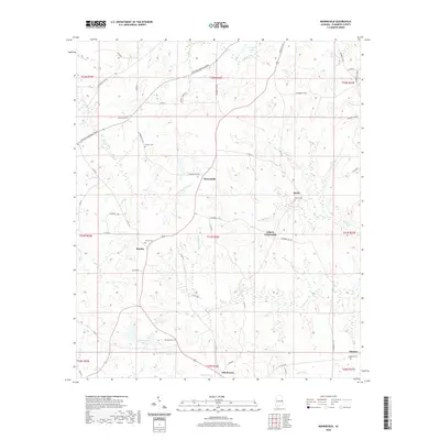
2020 Map of Moorefield
USGS Topo · Published 2020About this map
Oak Bowery and the surrounding rural landscape of Chambers County are defined by a network of creeks and small impoundments that have long shaped local land use. This modern survey illustrates how traditional crossroads settlements like Liberty Crossroads, Sturkie, and Boyds persist as markers of community identity amidst the rolling watershed of Little Chatahospee Cr and Halawakee Cr. The distribution of family and community burial grounds, including Sturkie Cem, Boyds Cem, and Spratling Cem, provides essential points of reference for genealogists tracking family lineages in this portion of Alabama. The landscape is dotted with several significant water bodies such as Jeff Beards Lake and Floyds Lake, while the Veterans Memorial Pkwy cuts across the northern reaches, signaling contemporary infrastructure laid over historical township lines.
Find a feature on this map
33 named features on this map. Tap any name to fly to it.
Don’t see what you’re looking for? This feature index may not catch every label — zoom into the map to look around manually.
Map Details
Editions of this 2020 Moorefield Map
This is the sole edition of this map. No revisions or reprints were ever made.
Other maps of this area

1906 · Dadeville
USGS Topo · 1:125,000

1907 · Opelika
USGS Topo · 1:125,000

1909 · Opelika
USGS Topo · 1:125,000

1955 · Phenix City
USGS Topo · 1:250,000

1957 · Phenix City
USGS Topo · 1:250,000

1958 · Phenix City
USGS Topo · 1:250,000

1970 · Opelika East
USGS Topo · 1:24,000

1971 · Waverly
USGS Topo · 1:24,000
1971 · Cusseta
USGS Topo · 1:24,000
1971 · Moorefield
USGS Topo · 1:24,000