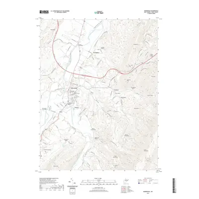
2019 Map of Moorefield
USGS Topo · Published 2019About this map
Moorefield serves as the focal point of this Hardy County landscape, where the South Branch Potomac River and the South Fork South Branch Potomac River meet. The town's historic core is anchored by the Hardy County Courthouse and several established burial grounds, including Olivet Cem and Oak Hill Cem. This 2019 survey documents a terrain defined by sharp ridges and deep hollows, such as Timber Ridge and Smokey Hollow, which hem in the river valleys. Smaller settlements like Tannery, Taylor, and Cunningham are spread along the highway corridors of Us Rte 220 and WV Rte 55. The topography is particularly complex to the east, where heights like Sugarloaf Knob and Coburn Knob rise above the drainage of Dumpling Run, illustrating the region's characteristic Appalachian ridge-and-valley formation.
Find a feature on this map
110 named features on this map. Tap any name to fly to it.
Don’t see what you’re looking for? This feature index may not catch every label — zoom into the map to look around manually.
Map Details
Editions of this 2019 Moorefield Map
This is the sole edition of this map. No revisions or reprints were ever made.
Other maps of this area

1891 · Romney
USGS Topo · 1:125,000

1892 · Franklin
USGS Topo · 1:125,000

1892 · Woodstock
USGS Topo · 1:125,000

1895 · Piedmont
USGS Topo · 1:125,000

1896 · Franklin
USGS Topo · 1:125,000

1920 · Petersburg
USGS Topo · 1:48,000

1920 · Moorefield
USGS Topo · 1:62,500

1921 · Orkney Springs
USGS Topo · 1:48,000

1921 · Petersburg
USGS Topo · 1:48,000

1921 · Greenland Gap
USGS Topo · 1:62,500