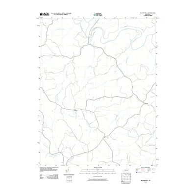
2010 Map of Moorefield
USGS Topo · Published 2010About this map
The Licking River carves a meandering course across the northern reaches of this Nicholas County landscape, defining a terrain of deep creek valleys and upland ridges. The settlement of Moorefield serves as a central hub for the local road network, where routes like Dixie Hwy and Jackson Rd connect rural homesteads. This 2010 survey illustrates a well-established agricultural pattern, with family-named corridors such as Hickey Rd and Durham Rd threading between drainage basins. To the east, the small community of Sprout sits near the confluence of Cane Run and Cassidy Creek, while Weston occupies the western portion of the map along Somerset Creek. The prevalence of small branches and forks, including Jerdan Branch and Brushy Fork, suggests a landscape historically dominated by small-scale farming and livestock operations dependent on these natural water sources.
Find a feature on this map
46 named features on this map. Tap any name to fly to it.
Don’t see what you’re looking for? This feature index may not catch every label — zoom into the map to look around manually.
Map Details
Editions of this 2010 Moorefield Map
This is the sole edition of this map. No revisions or reprints were ever made.
Other maps of this area

1952 · Cowan
USGS Topo · 1:24,000

1952 · Owingsville
USGS Topo · 1:24,000

1952 · Sharpsburg
USGS Topo · 1:24,000

1952 · Sherburne
USGS Topo · 1:24,000

1952 · Elizaville
USGS Topo · 1:24,000

1952 · North Middletown
USGS Topo · 1:24,000

1952 · Piqua
USGS Topo · 1:24,000

1953 · Carlisle
USGS Topo · 1:24,000

1953 · Moorefield
USGS Topo · 1:24,000

1956 · Louisville
USGS Topo · 1:250,000