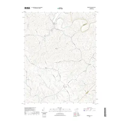
2019 Map of Moorefield
USGS Topo · Published 2019About this map
The Licking River winds through the northern portion of this landscape, crossed by the Licking River Bridge and fed by numerous tributaries including Fishrap Br and Fox Run. The area is defined by a dense network of country roads following the branching creek valleys and ridgelines of Nicholas County. Small rural hubs serve as the primary landmarks, including the settlements of Moorefield, Myers, Weston, and Sprout.
Find a feature on this map
67 named features on this map. Tap any name to fly to it.
Don’t see what you’re looking for? This feature index may not catch every label — zoom into the map to look around manually.
Map Details
Editions of this 2019 Moorefield Map
This is the sole edition of this map. No revisions or reprints were ever made.
Other maps of this area

1952 · Cowan
USGS Topo · 1:24,000

1952 · Owingsville
USGS Topo · 1:24,000

1952 · Sharpsburg
USGS Topo · 1:24,000

1952 · Sherburne
USGS Topo · 1:24,000

1952 · Elizaville
USGS Topo · 1:24,000

1952 · North Middletown
USGS Topo · 1:24,000

1952 · Piqua
USGS Topo · 1:24,000

1953 · Carlisle
USGS Topo · 1:24,000

1953 · Moorefield
USGS Topo · 1:24,000

1956 · Louisville
USGS Topo · 1:250,000