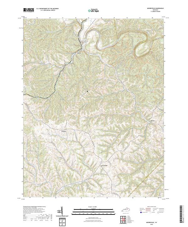
2022 Map of Moorefield
USGS Topo · Published 2022About this map
Moorefield serves as a central hub for this rural Kentucky landscape, where the headwaters of Somerset Cr and Jerdan Br carve through the terrain of southern Nicholas County. To the north, the Licking River forms a major geographic boundary, its meandering course shadowed by the Licking River Trl and the protected lands of the Clay WMA Rd (Lower Unit). This 2022 survey details a network of ridges and hollows defined by waterways like Cassidy Creek and Brushy Fork, connecting small settlements and family-named routes such as Myers Rd and Mount Zion Rd. Local history is anchored by the Locust Grove Church Cem situated along Locust Grove Rd, while the hamlet of Sprout marks the eastern reaches near the Bath County line. The map illustrates a traditional agricultural and residential layout, where development remains concentrated along established paths like Cane Run Rd and Hollar Rd.
Find a feature on this map
47 named features on this map. Tap any name to fly to it.
Don’t see what you’re looking for? This feature index may not catch every label — zoom into the map to look around manually.
Map Details
Editions of this 2022 Moorefield Map
This is the sole edition of this map. No revisions or reprints were ever made.
Other maps of this area

1952 · Cowan
USGS Topo · 1:24,000

1952 · Owingsville
USGS Topo · 1:24,000

1952 · Sharpsburg
USGS Topo · 1:24,000

1952 · Sherburne
USGS Topo · 1:24,000

1952 · Elizaville
USGS Topo · 1:24,000

1952 · North Middletown
USGS Topo · 1:24,000

1952 · Piqua
USGS Topo · 1:24,000

1953 · Carlisle
USGS Topo · 1:24,000

1953 · Moorefield
USGS Topo · 1:24,000

1956 · Louisville
USGS Topo · 1:250,000