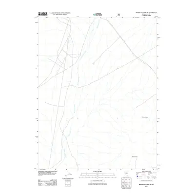
2012 Map of Moores Station SW
USGS Topo · Published 2012About this map
Moores Station Wash dominates the central and northern drainage patterns of this arid landscape in Nye County, Nevada. This 2012 survey illustrates the complex alluvial fan and desert wash systems typical of the Great Basin, where seasonal water flow carves distinct paths through the high desert. To the east, the terrain rises into the prominent elevation of Williams Ridge, while the southern portion of the sheet is anchored by the flat-topped volcanic or sedimentary formation of Halligan Mesa. The map serves as a primary record of the modern road network and geographic markers in this unpopulated region of Nevada, capturing the relationship between high desert topography and the ephemeral hydrology that defines the local environment.
Find a feature on this map
3 named features on this map. Tap any name to fly to it.
Don’t see what you’re looking for? This feature index may not catch every label — zoom into the map to look around manually.
Map Details
Editions of this 2012 Moores Station SW Map
This is the sole edition of this map. No revisions or reprints were ever made.
Other maps of this area

1956 · Tonopah
USGS Topo · 1:250,000

1959 · Tonopah
USGS Topo · 1:250,000

1962 · Tonopah
USGS Topo · 1:250,000

1967 · Lunar Crater
USGS Topo · 1:62,500

1967 · Moores Station
USGS Topo · 1:62,500

1967 · Blue Jay Spring
USGS Topo · 1:24,000

1967 · Moores Station SE
USGS Topo · 1:24,000

1967 · Palisade Mesa
USGS Topo · 1:24,000

1967 · Moores Station
USGS Topo · 1:24,000

1967 · Lunar Crater
USGS Topo · 1:24,000