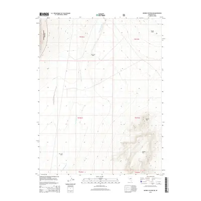
2014 Map of Moores Station SW
USGS Topo · Published 2014About this map
Hot Creek Valley dominates this high-desert landscape in Nye County, where the vast drainage of Moores Station Wash cuts through the center of the terrain. The eastern edge of the Toiyabe National Forest reaches into the western margins of the map, marking a transition from the alluvial valley floor to higher timbered elevations. This 2014 survey documents a region defined by dramatic geological formations, from the elevated plateau of Halligan Mesa in the southeast to the sharp rise of the Needle Range and Williams Ridge. The grid of the Public Land Survey System, including t9n r51e and t8n r52e, provides a framework for understanding the land tenure in this sparsely populated interior of Nevada, where seasonal watercourses and topographic landmarks served as primary navigational aids for early ranchers and explorers.
Find a feature on this map
12 named features on this map. Tap any name to fly to it.
Don’t see what you’re looking for? This feature index may not catch every label — zoom into the map to look around manually.
Map Details
Editions of this 2014 Moores Station SW Map
This is the sole edition of this map. No revisions or reprints were ever made.
Other maps of this area

1956 · Tonopah
USGS Topo · 1:250,000

1959 · Tonopah
USGS Topo · 1:250,000

1962 · Tonopah
USGS Topo · 1:250,000

1967 · Lunar Crater
USGS Topo · 1:62,500

1967 · Moores Station
USGS Topo · 1:62,500

1967 · Blue Jay Spring
USGS Topo · 1:24,000

1967 · Moores Station SE
USGS Topo · 1:24,000

1967 · Palisade Mesa
USGS Topo · 1:24,000

1967 · Moores Station
USGS Topo · 1:24,000

1967 · Lunar Crater
USGS Topo · 1:24,000