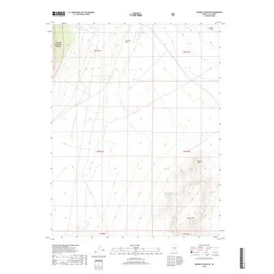
2018 Map of Moores Station SW
USGS Topo · Published 2018About this map
Hot Creek Valley occupies the central expanse of this High Desert landscape in Nye County, dominated by the drainage of Moores Station Wash. To the northwest, the boundary of the Toiyabe National Forest extends into the quadrangle, marking a transition into higher elevations. The topography is defined by significant rises such as Halligan Mesa in the south and Williams Ridge to the east, which sit below the distant peaks of the Needle Range. This 2018 survey reveals a terrain largely shaped by ephemeral watercourses and public land divisions, providing a clear view of the township and range grid including t9n r51e and t8n r52e. The lack of dense development underscores the area's character as an open corridor between mountain ranges, where the landscape remains primarily defined by its natural hydrology and geological formations.
Find a feature on this map
13 named features on this map. Tap any name to fly to it.
Don’t see what you’re looking for? This feature index may not catch every label — zoom into the map to look around manually.
Map Details
Editions of this 2018 Moores Station SW Map
This is the sole edition of this map. No revisions or reprints were ever made.
Other maps of this area

1956 · Tonopah
USGS Topo · 1:250,000

1959 · Tonopah
USGS Topo · 1:250,000

1962 · Tonopah
USGS Topo · 1:250,000

1967 · Lunar Crater
USGS Topo · 1:62,500

1967 · Moores Station
USGS Topo · 1:62,500

1967 · Blue Jay Spring
USGS Topo · 1:24,000

1967 · Moores Station SE
USGS Topo · 1:24,000

1967 · Palisade Mesa
USGS Topo · 1:24,000

1967 · Moores Station
USGS Topo · 1:24,000

1967 · Lunar Crater
USGS Topo · 1:24,000