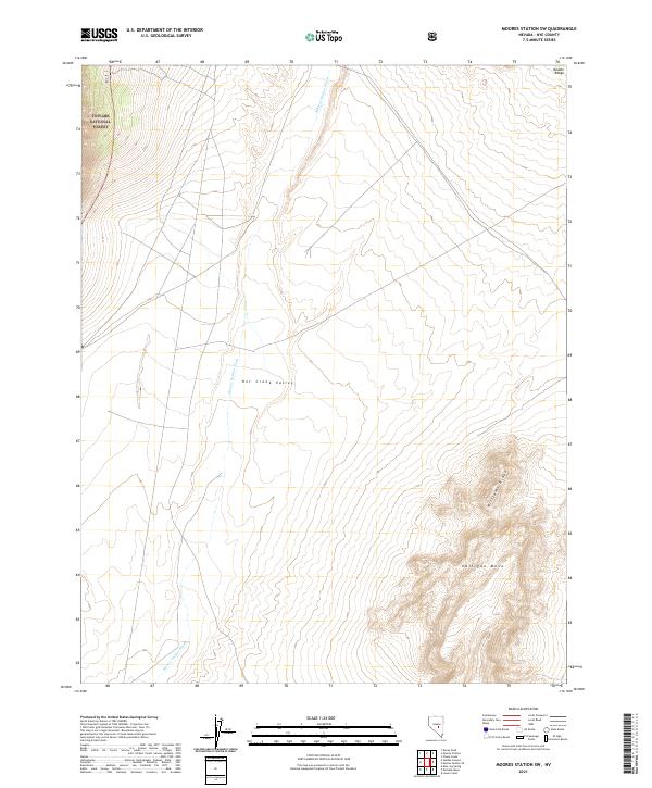
2021 Map of Moores Station SW
USGS Topo · Published 2021About this map
Hot Creek Valley dominates this high-desert basin in Nye County, showing the characteristic basin-and-range topography of central Nevada. The drainage of Moores Station Wash cuts through the center of the sheet, originating from the elevations of the Toiyabe National Forest in the northwest corner. This 2021 survey illustrates the stark geographic transition between the valley floor and the prominent geological formations of Halligan Mesa and Williams Ridge in the southeast. In the northeast, the map captures a portion of the Needle Range, providing a detailed view of the waterless washes and topographic relief that defined the ranching and transit corridors of this sparsely populated region. The lack of built infrastructure reflects the preservation of the open range and federal forest lands as they existed in the early twenty-first century.
Find a feature on this map
12 named features on this map. Tap any name to fly to it.
Don’t see what you’re looking for? This feature index may not catch every label — zoom into the map to look around manually.
Map Details
Editions of this 2021 Moores Station SW Map
This is the sole edition of this map. No revisions or reprints were ever made.
Other maps of this area

1956 · Tonopah
USGS Topo · 1:250,000

1959 · Tonopah
USGS Topo · 1:250,000

1962 · Tonopah
USGS Topo · 1:250,000

1967 · Lunar Crater
USGS Topo · 1:62,500

1967 · Moores Station
USGS Topo · 1:62,500

1967 · Blue Jay Spring
USGS Topo · 1:24,000

1967 · Moores Station SE
USGS Topo · 1:24,000

1967 · Palisade Mesa
USGS Topo · 1:24,000

1967 · Moores Station
USGS Topo · 1:24,000

1967 · Lunar Crater
USGS Topo · 1:24,000