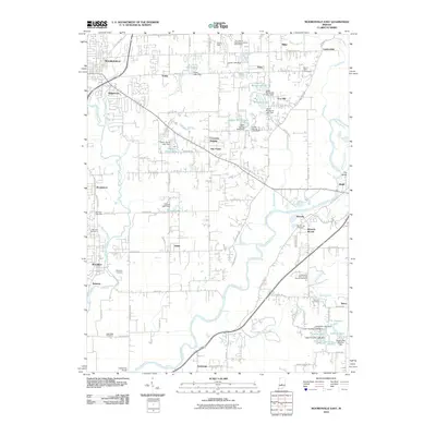
2010 Map of Mooresville East
USGS Topo · Published 2010About this map
The White River and White Lick Creek systems converge in this area of Morgan County, creating a landscape defined by water and early transportation routes. Settlement patterns follow the river's winding course, with the community of Waverly situated near a significant bend, while Brooklyn and Bethany anchor the southwestern portion of the sheet. The map reveals an extensive network of small private lakes and reservoirs, such as Arens Lake, Poplar Grove Lake, and Wildwood Lake, many of which are held by named dams like the Crouse Lake Dam.
Find a feature on this map
102 named features on this map. Tap any name to fly to it.
Don’t see what you’re looking for? This feature index may not catch every label — zoom into the map to look around manually.
Map Details
Editions of this 2010 Mooresville East Map
This is the sole edition of this map. No revisions or reprints were ever made.
Other maps of this area

1942 · Franklin
USGS Topo · 1:125,000

1947 · Franklin
USGS Topo · 1:62,500

1948 · Maywood
USGS Topo · 1:24,000

1948 · Trafalgar
USGS Topo · 1:24,000

1950 · Franklin
USGS Topo · 1:62,500

1952 · Bargersville
USGS Topo · 1:24,000

1953 · Bridgeport
USGS Topo · 1:24,000

1953 · Plainfield
USGS Topo · 1:24,000

1953 · Indianapolis
USGS Topo · 1:250,000

1955 · Cope
USGS Topo · 1:24,000