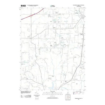
2010 Map of Mooresville West
USGS Topo · Published 2010About this map
The White River and its western tributaries define this area of Morgan County just south of the Indianapolis metropolitan fringe. The landscape transitions from the developed edge of Mooresville toward the rural hamlets of Monrovia and Gasburg. A network of private lakes and dams, such as Saint Mary-of-the-Woods Lake and Lake Hart, suggests a mid-century pattern of residential recreation and water management along Sycamore Creek. Near the high ground of Long Ridge, the Goethe Link Observatory stands as a notable scientific landmark, while several small airfields like Berling Airport and Kellys Airfield point to the region's history with general aviation.
Find a feature on this map
84 named features on this map. Tap any name to fly to it.
Don’t see what you’re looking for? This feature index may not catch every label — zoom into the map to look around manually.
Map Details
Editions of this 2010 Mooresville West Map
This is the sole edition of this map. No revisions or reprints were ever made.
Other maps of this area

1942 · Franklin
USGS Topo · 1:125,000

1953 · Bridgeport
USGS Topo · 1:24,000

1953 · Clayton
USGS Topo · 1:24,000

1953 · Plainfield
USGS Topo · 1:24,000

1953 · Indianapolis
USGS Topo · 1:250,000

1955 · Hall
USGS Topo · 1:24,000

1955 · Cope
USGS Topo · 1:24,000

1955 · Mooresville West
USGS Topo · 1:24,000

1955 · Martinsville
USGS Topo · 1:24,000

1955 · Mooresville East
USGS Topo · 1:24,000