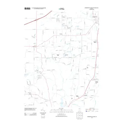
2013 Map of Mooresville West
USGS Topo · Published 2013About this map
White River and White Lick Cr define the hydrological landscape of this region west of Mooresville, where numerous small lakes and creeks intersect with rural communities. The map highlights a transition between residential pockets like Sundown Manor and established rural centers such as Monrovia and Centerton. A notable concentration of water bodies including Lake Hart, Lake Bodona, and Saint Mary-of-the-Woods Lake indicates the area's developed private and recreational drainage patterns. Historical and scientific interest is anchored by the Goethe Link Observatory situated on Long Ridge, alongside aviation landmarks like Mershon Airport. The presence of Bradford Woods and the nostalgically named Old Swimmin Hole Lake suggests a landscape shaped by both institutional conservation and local recreation during this era of Indiana's growth.
Find a feature on this map
109 named features on this map. Tap any name to fly to it.
Don’t see what you’re looking for? This feature index may not catch every label — zoom into the map to look around manually.
Map Details
Editions of this 2013 Mooresville West Map
This is the sole edition of this map. No revisions or reprints were ever made.
Other maps of this area

1942 · Franklin
USGS Topo · 1:125,000

1953 · Bridgeport
USGS Topo · 1:24,000

1953 · Clayton
USGS Topo · 1:24,000

1953 · Plainfield
USGS Topo · 1:24,000

1953 · Indianapolis
USGS Topo · 1:250,000

1955 · Hall
USGS Topo · 1:24,000

1955 · Cope
USGS Topo · 1:24,000

1955 · Mooresville West
USGS Topo · 1:24,000

1955 · Martinsville
USGS Topo · 1:24,000

1955 · Mooresville East
USGS Topo · 1:24,000