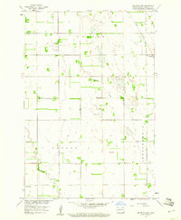
1959 Map of Mooreton NW
USGS Topo · Published 1960About this map
The agrarian townships of Colfax, Nansen, and Abercrombie define this 1959 topographic survey of Richland County. The landscape is characterized by its organized rural infrastructure, featuring a regular grid of section lines and a distributed network of local education including School No 1, School No 2, School No 3, and School No 4, alongside Ista Sch. These institutions, spaced across the prairie, reflect the mid-century settlement pattern of North Dakota's Red River Valley region.
Find a feature on this map
15 named features on this map. Tap any name to fly to it.
Don’t see what you’re looking for? This feature index may not catch every label — zoom into the map to look around manually.
Map Details
Editions of this 1959 Mooreton NW Map
2 editions found
Other maps of this area

1895 · Fargo
USGS Topo · 1:125,000

1895 · Casselton
USGS Topo · 1:125,000

1897 · Fargo
USGS Topo · 1:125,000

1897 · Casselton
USGS Topo · 1:125,000

1904 · Wahpeton
USGS Topo · 1:125,000

1907 · Wyndmere
USGS Topo · 1:125,000

1953 · Fargo
USGS Topo · 1:250,000

1956 · Fargo
USGS Topo · 1:250,000

1959 · Wyndmere NE
USGS Topo · 1:24,000

1959 · Mooreton NW
USGS Topo · 1:24,000