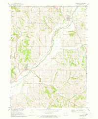
1971 Map of Moorhead
USGS Topo · Published 1973About this map
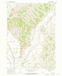
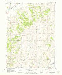
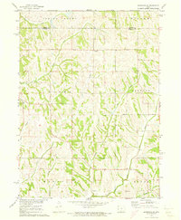
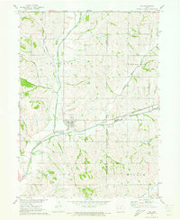
Moorhead and Soldier serve as the primary nodes of activity in this pocket of Monona County during the early 1970s. The landscape is defined by the winding course of the Soldier River, which dictates the placement of roads and homesteads across the terrain. Steep ridges and deep drainage patterns separate the river valley from smaller tributaries like Jordan Creek and Norway Creek. Genealogy and local history are anchored by the Soldier Cem and Spring Valley Cem, providing specific locations for ancestral research. The map captures a transition where traditional land divisions meet the natural flow of waterways like Spring Valley Creek and Elk Creek, illustrating the intersection of Iowa's agricultural grid with its more varied, dissected western topography.
Find a feature on this map
11 named features on this map. Tap any name to fly to it.
Don’t see what you’re looking for? This feature index may not catch every label — zoom into the map to look around manually.
Map Details
Editions of this 1971 Moorhead Map
This is the sole edition of this map. No revisions or reprints were ever made.
Other maps of this area

1954 · Omaha
USGS Topo · 1:250,000

1954 · Fort Dodge
USGS Topo · 1:250,000

1957 · Omaha
USGS Topo · 1:250,000

1957 · Fort Dodge
USGS Topo · 1:250,000

1958 · Omaha
USGS Topo · 1:250,000

1958 · Fort Dodge
USGS Topo · 1:250,000
1969 · Castana
USGS Topo · 1:24,000
1971 · Mapleton SE
USGS Topo · 1:24,000
1971 · Moorhead SE
USGS Topo · 1:24,000
1971 · Ute
USGS Topo · 1:24,000