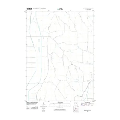
2010 Map of Moorhead NW
USGS Topo · Published 2010About this map
The Little Sioux River and the Soldier River define the hydraulic character of this Monona County landscape, carving through a region marked by deep valleys and the distinctive drainage patterns of the Monona Harrison Ditch. This 2010 survey highlights the settlement of Preparation, a location with deep roots in local history, flanked by the Preparation Canyon Cemetery and Bethesda Cemetery. The road network is dominated by the Larpenteur Memorial Rd, which traces the undulating terrain alongside numerous local routes like Co Hwy E54 and Preparation Canyon Rd. Small waterways such as Cottonwood Creek and Beaver Creek further intersect the agricultural grid, illustrating the intricate relationship between the loess hills topography and the rural development of western Iowa.
Find a feature on this map
32 named features on this map. Tap any name to fly to it.
Don’t see what you’re looking for? This feature index may not catch every label — zoom into the map to look around manually.
Map Details
Editions of this 2010 Moorhead NW Map
This is the sole edition of this map. No revisions or reprints were ever made.
Other maps of this area

1954 · Omaha
USGS Topo · 1:250,000

1954 · Fort Dodge
USGS Topo · 1:250,000

1955 · Sioux City
USGS Topo · 1:250,000

1955 · Fremont
USGS Topo · 1:250,000

1957 · Fremont
USGS Topo · 1:250,000

1957 · Omaha
USGS Topo · 1:250,000

1957 · Fort Dodge
USGS Topo · 1:250,000

1958 · Sioux City
USGS Topo · 1:250,000

1958 · Omaha
USGS Topo · 1:250,000

1958 · Fremont
USGS Topo · 1:250,000