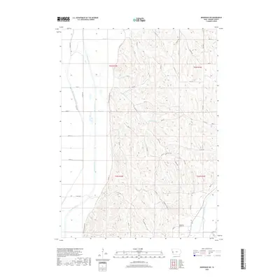
2018 Map of Moorhead NW
USGS Topo · Published 2018About this map
Bethesda Cem and Preparation Canyon Cem mark the high ground of Monona County, Iowa, on this 2018 survey. The landscape is defined by the sharp contrast between the flat, engineered floodplain to the west and the deeply dissected bluffs to the east. The Little Sioux River and the parallel Monona Harrison Ditch dominate the western lowlands, following a strictly linear north-south path through the valley floor. In the eastern hills, the drainage pattern is much more complex, with Cottonwood Cr and Beaver Cr carving intricate ravines through the Loess Hills. This area shows a sparse settlement pattern connected by a network of rural roads like Larpenteur Memorial Rd and Preparation Canyon Rd, which wind through the difficult topography where the Soldier River valley begins to broaden.
Find a feature on this map
42 named features on this map. Tap any name to fly to it.
Don’t see what you’re looking for? This feature index may not catch every label — zoom into the map to look around manually.
Map Details
Editions of this 2018 Moorhead NW Map
This is the sole edition of this map. No revisions or reprints were ever made.
Other maps of this area

1954 · Omaha
USGS Topo · 1:250,000

1954 · Fort Dodge
USGS Topo · 1:250,000

1955 · Sioux City
USGS Topo · 1:250,000

1955 · Fremont
USGS Topo · 1:250,000

1957 · Fremont
USGS Topo · 1:250,000

1957 · Omaha
USGS Topo · 1:250,000

1957 · Fort Dodge
USGS Topo · 1:250,000

1958 · Sioux City
USGS Topo · 1:250,000

1958 · Omaha
USGS Topo · 1:250,000

1958 · Fremont
USGS Topo · 1:250,000