
1971 Map of Moorhead SE
USGS Topo · Published 1973About this map
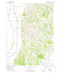
Allen Creek Chapel stands as a spiritual landmark in this 1971 survey of western Iowa, where the landscape is defined by the transition from the Monona Co Harrison Co line down into the township of Allen. The area is characterized by a dense network of watercourses, including Allen Creek, Willow Creek, and Elk Creek, which carved the drainage patterns that dictated early road placement and property boundaries. These physical features reflect the rural organization of several townships, including Spring Valley, Lincoln, and Magnolia. This map captures the agricultural footprint of the early 1970s, documented by photogrammetric methods to show the precise relationship between section lines, rural homesteads, and the winding path of Steer Creek and Thompson Creek.
Find a feature on this map
19 named features on this map. Tap any name to fly to it.
Don’t see what you’re looking for? This feature index may not catch every label — zoom into the map to look around manually.
Map Details
Editions of this 1971 Moorhead SE Map
This is the sole edition of this map. No revisions or reprints were ever made.
Other maps of this area

1954 · Omaha
USGS Topo · 1:250,000

1957 · Omaha
USGS Topo · 1:250,000

1958 · Omaha
USGS Topo · 1:250,000

1970 · Logan
USGS Topo · 1:24,000
1970 · Missouri Valley NW
USGS Topo · 1:24,000

1971 · Dunlap SW
USGS Topo · 1:24,000
1971 · Moorhead
USGS Topo · 1:24,000
1971 · Dunlap NW
USGS Topo · 1:24,000
1971 · Pisgah
USGS Topo · 1:24,000
1971 · Moorhead NW
USGS Topo · 1:24,000