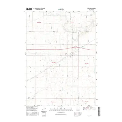
2015 Map of Moorland
USGS Topo · Published 2015About this map
Moorland serves as a central hub for this section of Webster County, situated where Co Rd D20 intersects the rail lines and agricultural corridors of the northern plains. The landscape is defined by its meticulous drainage systems, including Ditch Number 31 and Ditch Number 96, which manage the low-lying terrain between the winding South Branch Lizard Creek and Hardin Cr. Genealogists and local historians will find several distinct burial grounds scattered throughout the townships, such as Fulton Township Cem and the uniquely named Mizpah Cem in the southwestern corner. Small rural clusters like Roelyn and Tara mark the periphery, while the surrounding grid of section roads like Easter Ave and Dakota Ave illustrates the enduring layout of Iowa's family farming heritage.
Find a feature on this map
47 named features on this map. Tap any name to fly to it.
Don’t see what you’re looking for? This feature index may not catch every label — zoom into the map to look around manually.
Map Details
Editions of this 2015 Moorland Map
This is the sole edition of this map. No revisions or reprints were ever made.
Other maps of this area

1923 · Lehigh
USGS Topo · 1:62,500

1923 · Fort Dodge
USGS Topo · 1:62,500

1954 · Fort Dodge
USGS Topo · 1:250,000

1957 · Fort Dodge
USGS Topo · 1:250,000

1958 · Fort Dodge
USGS Topo · 1:250,000

1965 · Moorland
USGS Topo · 1:24,000

1965 · Farnhamville
USGS Topo · 1:24,000

1965 · Fort Dodge South
USGS Topo · 1:24,000

1965 · Knierim
USGS Topo · 1:24,000

1965 · Gowrie
USGS Topo · 1:24,000