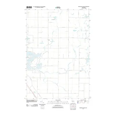
2010 Map of Moose Ear Lake
USGS Topo · Published 2010About this map
Lake Chetek and Tenmile Lake dominate the southwestern reaches of this Wisconsin landscape, where a complex network of waterways defines the local geography. The map traces the winding courses of Moose Ear Creek and Tenmile Creek as they feed into larger basins like Moose Ear Lake and Pokegama Lake. This aquatic system is managed in part by the Eyk E2980 Dam, located north of Jacobson Lake. For those researching local heritage, the placement of the Johnson Cemetery and Twin Lakes Cemetery provides essential markers of the community's established history. The land is organized by a precise grid of rural routes such as Hogsback Rd and Sunset View Rd, illustrating the intersection of natural glacial hydrology and orderly Midwestern land division.
Find a feature on this map
50 named features on this map. Tap any name to fly to it.
Don’t see what you’re looking for? This feature index may not catch every label — zoom into the map to look around manually.
Map Details
Editions of this 2010 Moose Ear Lake Map
This is the sole edition of this map. No revisions or reprints were ever made.
Other maps of this area

1948 · Weyerhauser
USGS Topo · 1:48,000

1949 · Bloomer
USGS Topo · 1:62,500

1949 · New Auburn
USGS Topo · 1:62,500

1950 · Weyerhauser
USGS Topo · 1:48,000

1951 · Bloomer
USGS Topo · 1:62,500

1951 · New Auburn
USGS Topo · 1:62,500

1951 · Chetek
USGS Topo · 1:62,500

1953 · Rice Lake
USGS Topo · 1:250,000

1959 · Rice Lake
USGS Topo · 1:250,000
1972 · Chain Lake
USGS Topo · 1:24,000