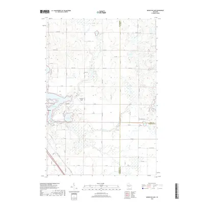
2018 Map of Moose Ear Lake
USGS Topo · Published 2018About this map
Moose Ear Lake and the eastern outskirts of Chetek define this glacial landscape where three Wisconsin counties—Barron, Rusk, and Chippewa—converge. The area is characterized by a dense network of water bodies, including Lake Chetek, Tenmile Lake, and Bass Lake, connected by winding waterways like Tenmile Creek and Moose Ear Cr. These lakes dominate the western portion of the map, while the eastern section reveals a complex wetland environment around Beauty Lake and Fish Lake.
Find a feature on this map
51 named features on this map. Tap any name to fly to it.
Don’t see what you’re looking for? This feature index may not catch every label — zoom into the map to look around manually.
Map Details
Editions of this 2018 Moose Ear Lake Map
This is the sole edition of this map. No revisions or reprints were ever made.
Other maps of this area

1948 · Weyerhauser
USGS Topo · 1:48,000

1949 · Bloomer
USGS Topo · 1:62,500

1949 · New Auburn
USGS Topo · 1:62,500

1950 · Weyerhauser
USGS Topo · 1:48,000

1951 · Bloomer
USGS Topo · 1:62,500

1951 · New Auburn
USGS Topo · 1:62,500

1951 · Chetek
USGS Topo · 1:62,500

1953 · Rice Lake
USGS Topo · 1:250,000

1959 · Rice Lake
USGS Topo · 1:250,000
1972 · Chain Lake
USGS Topo · 1:24,000