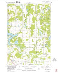
1978 Map of Moose Ear Lake
USGS Topo · Published 1979About this map
The glacially carved landscape of Northwest Wisconsin is on full display in this late-1970s survey, defined by the intricate network of the Chetek chain of lakes. The confluence of Moose Ear Creek and Tenmile Creek feeds into prominent water bodies like Lake Chetek and Tenmile Lake, where the presence of Barron County Park and multiple public access points indicates a well-established recreational economy by this era. On the western edge, the Chicago and North Western railroad corridor cuts through the township of Dovre, marking a legacy of industrial transport in a region otherwise dominated by wetlands and agriculture.
Find a feature on this map
42 named features on this map. Tap any name to fly to it.
Don’t see what you’re looking for? This feature index may not catch every label — zoom into the map to look around manually.
Map Details
Editions of this 1978 Moose Ear Lake Map
This is the sole edition of this map. No revisions or reprints were ever made.
Other maps of this area

1948 · Weyerhauser
USGS Topo · 1:48,000

1949 · Bloomer
USGS Topo · 1:62,500

1949 · New Auburn
USGS Topo · 1:62,500

1950 · Weyerhauser
USGS Topo · 1:48,000

1951 · Bloomer
USGS Topo · 1:62,500

1951 · New Auburn
USGS Topo · 1:62,500

1951 · Chetek
USGS Topo · 1:62,500

1953 · Rice Lake
USGS Topo · 1:250,000

1959 · Rice Lake
USGS Topo · 1:250,000
1972 · Chain Lake
USGS Topo · 1:24,000