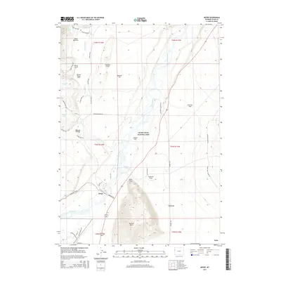
2015 Map of Moose
USGS Topo · Published 2015About this map
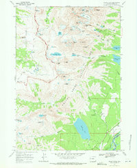
Grand Teton National Park occupies much of this map, showcasing the dramatic transition from the valley floor of Jackson Hole to the alpine features of the mountain front. The Snake River winds through the center of the sheet, flanked by the glacial moraines of Timbered Island and the prominent rising mass of Blacktail Butte. Human history is deeply etched into the landscape here, most notably along Mormom Row and in the small communities of Kelly, Grovont, and Moose. The road network, including the Teton Park Rd and Inner Park Rd, facilitates access to iconic water bodies like Jenny Lake, Bradley Lake, and Taggart Lake. This survey illustrates the intricate balance between preserved wilderness areas like Lupine Meadows and the long-established settlements that once served as the foundational homesteads for this high-altitude valley.
Find a feature on this map
87 named features on this map. Tap any name to fly to it.
Don’t see what you’re looking for? This feature index may not catch every label — zoom into the map to look around manually.
Map Details
Editions of this 2015 Moose Map
This is the sole edition of this map. No revisions or reprints were ever made.
Other maps of this area

1899 · Grand Teton
USGS Topo · 1:125,000

1901 · Grand Teton
USGS Topo · 1:125,000

1955 · Driggs
USGS Topo · 1:250,000

1958 · Driggs
USGS Topo · 1:250,000

1962 · Driggs
USGS Topo · 1:250,000
1968 · Teton Village
USGS Topo · 1:24,000

1968 · Moose
USGS Topo · 1:24,000
1968 · Blue Miner Lake
USGS Topo · 1:24,000
1968 · Shadow Mountain
USGS Topo · 1:24,000
1968 · Grand Teton
USGS Topo · 1:24,000