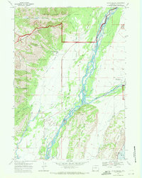
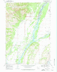
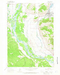
1968 Map of Teton Village
USGS Topo · Published 1971About this map
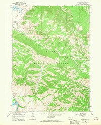
Rendezvous Mountain and the development of the modern ski area define this late 1960s landscape near Teton Village. The map captures the infrastructure of early mountain recreation, including the Aerial Tramway and Ski Lift ascending toward Apres Vous Peak. Below the slopes, the Jackson Hole valley floor is dominated by the braided channels of the Snake River, bordered by the expansive reaches of Grand Teton National Park and the Teton National Forest.
Find a feature on this map
33 named features on this map. Tap any name to fly to it.
Don’t see what you’re looking for? This feature index may not catch every label — zoom into the map to look around manually.
Map Details
Editions of this 1968 Teton Village Map
2 editions found
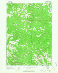
Other maps of this area

1899 · Grand Teton
USGS Topo · 1:125,000

1901 · Grand Teton
USGS Topo · 1:125,000

1931 · Jackson
USGS Topo · 1:125,000

1935 · Jackson
USGS Topo · 1:125,000

1955 · Driggs
USGS Topo · 1:250,000

1958 · Driggs
USGS Topo · 1:250,000

1962 · Driggs
USGS Topo · 1:250,000
1963 · Jackson
USGS Topo · 1:24,000
1963 · Teton Pass
USGS Topo · 1:24,000
1965 · Cache Creek
USGS Topo · 1:24,000