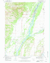
1968 Map of Teton Village
USGS Topo · Published 1974About this map
Teton Village sits at the base of the Rendezvous Mountain ski area, which at this time featured an Aerial Tramway and Ski Lift infrastructure leading toward Apres Vous Peak. The landscape is defined by the massive braided channel of the Snake River flowing through Jackson Hole, where it meets the Gros Ventre River near the northern tip of the West Gros Ventre Butte. This 1968 survey documents the intersection of public lands and recreation, showing the boundaries of Grand Teton National Park and the Teton National Forest meeting private developments like the Jackson Hole Country Club. To the south, the settlement of Wilson marks the transition from the valley floor to the foothills of Phillips Ridge, while the National Elk Refuge occupies the eastern edge of the quadrangle.
Find a feature on this map
30 named features on this map. Tap any name to fly to it.
Don’t see what you’re looking for? This feature index may not catch every label — zoom into the map to look around manually.
Map Details
Editions of this 1968 Teton Village Map
2 editions found
Other maps of this area

1899 · Grand Teton
USGS Topo · 1:125,000

1901 · Grand Teton
USGS Topo · 1:125,000

1931 · Jackson
USGS Topo · 1:125,000

1935 · Jackson
USGS Topo · 1:125,000

1955 · Driggs
USGS Topo · 1:250,000

1958 · Driggs
USGS Topo · 1:250,000

1962 · Driggs
USGS Topo · 1:250,000

1963 · Jackson
USGS Topo · 1:24,000

1963 · Teton Pass
USGS Topo · 1:24,000
1965 · Cache Creek
USGS Topo · 1:24,000