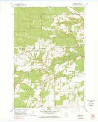
1964 Map of Moquah
USGS Topo · Published 1978About this map
Chequamegon National Forest dominates the northern reaches of this map, transitioning south into a landscape defined by small agricultural settlements and timber transport lines during the mid-1960s. The village of Moquah serves as a central hub, situated along the Northern Pacific railroad line, while further south, the community of Benoit marks a junction point near the Chicago and North Western tracks. This region in Bayfield County is heavily intersected by the many branches of the Fish Creek watershed, including North Fork Fish Creek and South Fork Fish Creek. Local infrastructure for rural life is well-documented, from the St Peters Ch and an adjacent Cem to the local Townhall. Numerous Gravel Pit and Sandpit labels across the townships of Pilsen and Keystone suggest an economy rooted in local material extraction and road building during this era.
Find a feature on this map
27 named features on this map. Tap any name to fly to it.
Don’t see what you’re looking for? This feature index may not catch every label — zoom into the map to look around manually.
Map Details
Editions of this 1964 Moquah Map
2 editions found
Other maps of this area

1942 · Ashland
USGS Topo · 1:48,000

1942 · Marengo
USGS Topo · 1:48,000

1944 · Moquah
USGS Topo · 1:48,000

1944 · Grandview
USGS Topo · 1:48,000

1945 · Marengo
USGS Topo · 1:48,000

1947 · Moquah
USGS Topo · 1:48,000

1947 · Ashland
USGS Topo · 1:48,000

1947 · Grandview
USGS Topo · 1:48,000

1953 · Ashland
USGS Topo · 1:250,000

1958 · Ashland
USGS Topo · 1:250,000