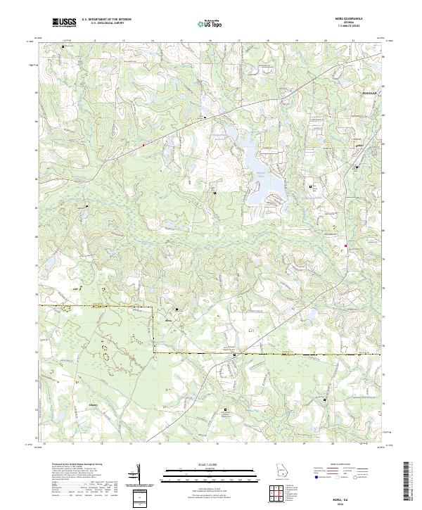
2024 Map of Mora
USGS Topo · Published 2024About this map
The Satilla River flows across this South Georgia landscape, defining the rural character of the borderlands between Coffee and Atkinson counties. The settlement of Mora serves as a central point in this agricultural region, situated near the Mora Cem and Arna Primitive Baptist Church. To the south, the community of Oberry is positioned near Mill Creek and Dark Bay, while Bethel and its namesake Bethel Cem sit to the northeast. Numerous small family and community cemeteries, such as Saint Illa Cem, Daniel Cem, and Hebron Cem, are scattered throughout the quadrangle, offering significant points of interest for genealogists tracing South Georgia roots. The landscape is further shaped by several water bodies, including Holiday Beach North Lake, Hilliards Pond, and the Satilla River Hills, illustrating the low-lying, creek-veined terrain typical of the wiregrass region.
Find a feature on this map
151 named features on this map. Tap any name to fly to it.
Don’t see what you’re looking for? This feature index may not catch every label — zoom into the map to look around manually.
Map Details
Editions of this 2024 Mora Map
This is the sole edition of this map. No revisions or reprints were ever made.
Other maps of this area

1953 · Waycross
USGS Topo · 1:250,000

1958 · Waycross
USGS Topo · 1:250,000

1971 · Douglas North
USGS Topo · 1:24,000

1971 · Douglas South
USGS Topo · 1:24,000

1971 · Pearson
USGS Topo · 1:24,000

1972 · Kirkland
USGS Topo · 1:24,000

1972 · Willacoochee
USGS Topo · 1:24,000

1972 · Lax
USGS Topo · 1:24,000

1972 · Ambrose
USGS Topo · 1:24,000

1972 · Mora
USGS Topo · 1:24,000