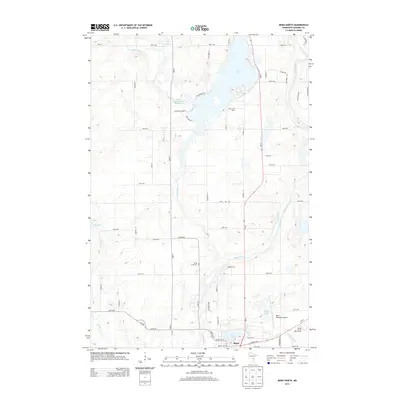
2013 Map of Mora North
USGS Topo · Published 2013About this map
The Snake River and Knife River converge near the northern limits of Mora, anchoring a landscape defined by significant water resources in Kanabec County. Central to the region is the expansive Knife Lake, which is supported by the Carda Impoundment Reservoir and smaller features like Bean Brook. The settlement of Mora occupies the southern edge of the map, where civil infrastructure such as the Mora Municipal Airport and the Spring Brook Golf Course sit near the banks of Mora Lake and Spring Lake. Local history and genealogy interests are represented by the Knife Lake Cem and the Knife Lake Dairy, located north of the town center. The map reveals a transition from the structured street grid of the town to a rural network of numbered avenues and named roads like Salmonson River Rd and Gilbertsons Hl, tracing the natural drainage patterns of the Ann River and Spring Brook systems.
Find a feature on this map
61 named features on this map. Tap any name to fly to it.
Don’t see what you’re looking for? This feature index may not catch every label — zoom into the map to look around manually.
Map Details
Editions of this 2013 Mora North Map
This is the sole edition of this map. No revisions or reprints were ever made.
Other maps of this area

1953 · Duluth
USGS Topo · 1:250,000

1953 · Stillwater
USGS Topo · 1:250,000

1955 · Stillwater
USGS Topo · 1:250,000

1958 · Stillwater
USGS Topo · 1:250,000

1958 · Duluth
USGS Topo · 1:250,000

1961 · Brook Park
USGS Topo · 1:62,500

1965 · Stillwater
USGS Topo · 1:250,000

1968 · Ann Lake
USGS Topo · 1:24,000

1968 · Isle SW
USGS Topo · 1:24,000

1968 · Mora North
USGS Topo · 1:24,000