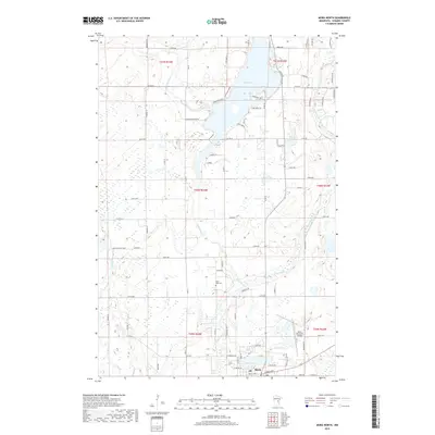
2019 Map of Mora North
USGS Topo · Published 2019About this map
The Snake River and Knife River converge north of Mora, shaping a landscape defined by riparian corridors and glacial water bodies. This 2019 survey captures the northern outskirts of the Kanabec County seat, where the residential grids of the town transition into the agricultural and wooded lands of the surrounding townships. Central to the area is Knife Lake, which serves as a geographic anchor for local landmarks like the Knife Lake Cem and small residential developments such as Chris Haven and Little Tealander.
Find a feature on this map
82 named features on this map. Tap any name to fly to it.
Don’t see what you’re looking for? This feature index may not catch every label — zoom into the map to look around manually.
Map Details
Editions of this 2019 Mora North Map
This is the sole edition of this map. No revisions or reprints were ever made.
Other maps of this area

1953 · Duluth
USGS Topo · 1:250,000

1953 · Stillwater
USGS Topo · 1:250,000

1955 · Stillwater
USGS Topo · 1:250,000

1958 · Stillwater
USGS Topo · 1:250,000

1958 · Duluth
USGS Topo · 1:250,000

1961 · Brook Park
USGS Topo · 1:62,500

1965 · Stillwater
USGS Topo · 1:250,000

1968 · Ann Lake
USGS Topo · 1:24,000

1968 · Isle SW
USGS Topo · 1:24,000

1968 · Mora North
USGS Topo · 1:24,000