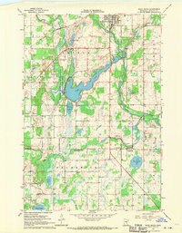
1968 Map of Mora South
USGS Topo · Published 1970About this map
Snake River meanders through Kanabec County, anchoring a landscape shaped by water and the Great Northern rail corridor during the late 1960s. The northern reaches show the expansion of Mora, where a prominent Water Tank stands near the St Marys Cem. Moving south into the townships of Arthur and Brunswick, the terrain transitions into a mosaic of wetlands and small lakes, including Kent Lake, Pennington Lake, and the larger Fish Lake.
Find a feature on this map
27 named features on this map. Tap any name to fly to it.
Don’t see what you’re looking for? This feature index may not catch every label — zoom into the map to look around manually.
Map Details
Editions of this 1968 Mora South Map
2 editions found
Other maps of this area

1953 · Stillwater
USGS Topo · 1:250,000

1955 · Stillwater
USGS Topo · 1:250,000

1958 · Stillwater
USGS Topo · 1:250,000

1961 · Cambridge
USGS Topo · 1:62,500

1961 · Brook Park
USGS Topo · 1:62,500

1961 · Springvale
USGS Topo · 1:24,000

1961 · Dalbo
USGS Topo · 1:24,000

1961 · Dalbo
USGS Topo · 1:62,500

1965 · Stillwater
USGS Topo · 1:250,000

1968 · Ann Lake
USGS Topo · 1:24,000